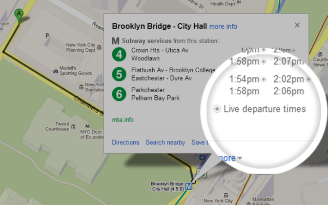
As a New York resident, I rely on public transport a lot, a New Yorker knows too well that minute delay, could cause a whole chain reaction for commute. Google announced that they are bringing live departure times today, for seven lines on the New York City subway system, buses and Salt Lake City. Now I can grab some extra snooze, and still catch the bus to the ferry. The upgrade extends to Washington DC’s Metrorail, which would bring live service alerts, “including unplanned delays and scheduled track work, straight from Metro’s Control Center on Google Maps. To adjust your travel around the alerts you see, simply choose another suggested route or change your departure time.”
With transit information in Google Maps you get pick-up locations, departure times, estimated travel time, and even fare amounts for 800 cities* across more than 25 countries around the world – that’s information for 100 million miles of daily public transit trips at your fingertips.
The service is available on the Android device or iPhone
Source: Google


